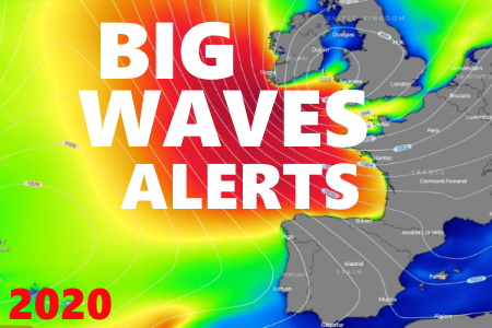
Big wave season is ON - September
"Let the hunt begin!" by Bruno Lampreia
September equinox marks the beginning of progressively longer nights and shorter days over the Northern Hemisphere, now we are officially entering Autumn and the big wave season at Nazaré, as expected, all eyes worldwide are focused on this big wave mecca.
All over the world, enthusiasts, top athletes and wave forecasters are starting to scan the “wave radar” and searching for “weather bombs”, meaning very intense low-pressure systems that are able to produce large scale swells towards the Portuguese West Coast. There are so many factors to consider, the position of the low-pressure, it’s intensity, the distance the swell has to travel to the spot and the sea state during that journey, the wind conditions and weather at Nazaré by the time of the arrival of the waves, etc.
This means that the hunt for the perfect storm is now on! As of this moment the weather chart analysis becomes a daily routine, anxious athletes will be on hold for a “call” and forecasters will be scanning various atmospheric and oceanic models for a favorable low-pressure, from there to the increasing probability of materializing in real events and all the consequent calculations of its effects to the time that they will star planning trips, organizing events, preparing all the necessary hardware and the never-ending logistics, this is the moment were a frenetic work will take place to measure if all variables are lining up for the end result, the giant waves. However, the rarest and hardest event will be the PERFECT GIANT WAVE!
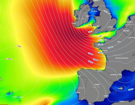
Concerning the current situation we have ODETTE low-pressure over the British Isles, triggering a NNW-NW swell with medium-long period and sizes ranging between 10-13’ peaking through late Friday and early Saturday (25-26th September 2020) over Nazaré area, however the persisting Northern wind will linger through the first half of the next week and predominant intensities are from moderate to strong, fading later, the general sea conditions are quite choppy as the regional wind will create plenty of windswell.
Further ahead by late next week a new low-pressure is expected to the West of the British Isles, producing a new swell pulse as from Friday from the NW with medium to long periods, although the wind shifting West will be a problem and it’s expected to affect the conditions.

Picture 1: Significant wave height, chart valid for Thursday 24th September 2020 at 15:00 Local time. Source: windy.com
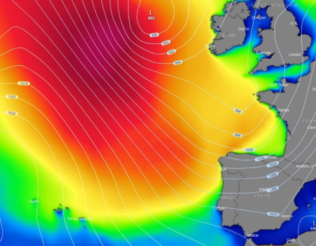
Picture 2: Significant wave height, chart valid for Friday 2nd October 2020 at 12:00 Local time. Source: windy.com
Stay tuned as we at nazarewaves.com will be looking for the perfect conditions and will keep scanning the weather charts on the hunt for the “perfect storm”, promptly we will be posting all developments as the events over the North Atlantic unfolds.
By: Bruno Lampreia.
Contacts: Facebook or email meteoceansurf@gmail.com