Big wave event
Big waves with stormy conditions
The North Atlantic is starting to produce a few low-pressure centers with the potential for big waves, however the position of these lows did not just yet directed big swells over Portugal Mainland West Coast. At the moment of the release of this article, the charts are indicating a low-pressure prone to trigger significative events.
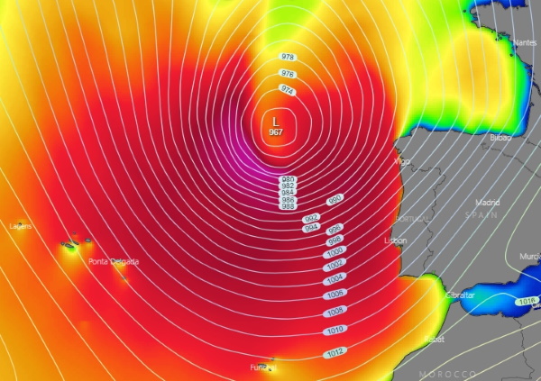
Picture 1: Significant wave height, chart valid for Sunday 18 October 2020 at 12:00 Local time. Source: windy.com
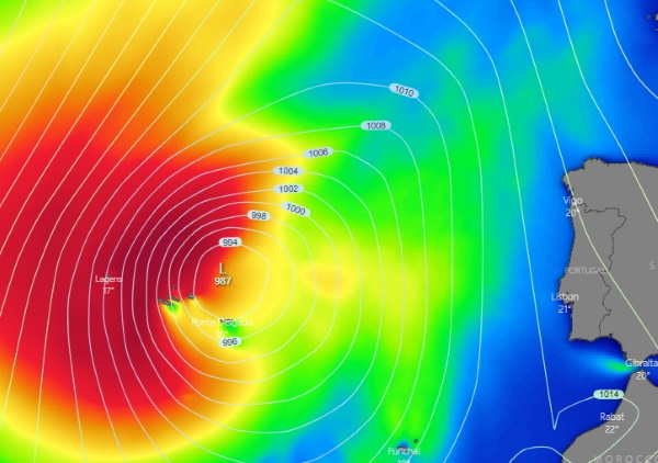
On the 16th of October, Friday, charts are showing a low-pressure to the West of the British Isles moving towards a region to the North of the Azores Islands, the Western group will be the first to be affected and extending gradually to the rest of the Isles with big waves, strong winds and significant precipitation.
Picture 2: significant wave height, chart valid for Tuesday 20 October 2020 at 12:00 Local time. Source: windy.com
Further ahead this low-pressure gathers strength and moves East towards the Portuguese mainland West Coast and then veering North, producing a big swell event, although the position of this low will induce strong Southwest winds, resulting on big choppy seas under stormy conditions with sizes ranging 17’ to 20’+ (still premature sizes on models) as from Tuesday 20 of October, also expected heavy to moderate precipitation. Weather warning and nautical restricted are expected to be issued by the authorities.
By: Bruno Lampreia.
Contacts: Facebook or email meteoceansurf@gmail.com
